One question that comes up time and again on the trail is whether to stick to the maps produced by the Adventure Cycling Association. Often the suggested route will weave and turn when there appears to be a much more straightforward and more direct alternative. The temptation to cut off a loop, or take a different road is strong – but beware – going off piste is almost always a mistake.
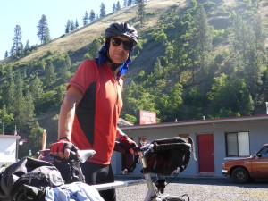
Wanting to avoid sunstroke I adopt the ‘Lawrence of Arabia’ look with a wet tea-towel draped over my head
The ACA has been drawing up these maps since 1976 and they’ve developed over time to provide the safest and most interesting crossing. They are tweaked and updated all the time to take into account road changes and you go off route at your peril. Rarely have we met anyone who struck out on their own and found a better option. In fact horror stories abound.
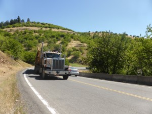
Today was a case in point. We had to cycle from Kooskia to Grangeville. The ACA route takes you on a steep climb north – you winch up nearly two thousand feet in a few miles. However an alternative published in older maps takes you on a slightly longer, but far more gentle route via Harpster. Due to a navigating error Terry and I found ourselves on the old route – at first all seemed fine – it was a climb, but nothing worse than around six percent. So what was the problem?
It didn’t take long to find out, because we were soon sharing the road with giant logging lorries, struggling up the pass with heavy loads and tight weaving bends to negotiate. Worse still in some places the shoulder was very narrow – and on the side going East, often non existent. And because the gradient was less severe it went on for longer. In all 28 logging trucks passed us – 15 going up, 13 down. It was difficult not to feel vulnerable and I pulled over for most of them.
Later we met up with Jerry, Jonathan and Mike who’d taken the correct route – yes it was steep and the cycling was a struggle, but it was virtually free from traffic. So there you go – ignore the maps at your peril.
The other important thing not to ignore is the weather and Idaho is scorching at present with temperatures cooking up to 104 degrees in the midday sun. As I found out yesterday, riding in these conditions is madness, so today we adopted a different strategy. After mixing with the loggers for the morning we took the afternoon off and cooled down in Grangeville, finding a perfect resting spot at Crema Cafe where the friendly staff served us muffins, lattes and tea (yes proper hot tea with milk – bliss) all afternoon long. We’d been there for an hour or so when Tuan popped in and joined the chill-out. By the time we ventured out into the cool of the evening we’d been surfing the wifi an eating and drinking for more than four hours. A little oasis from life on the road.
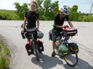
It was great to hear that Keenan, left, has made it home to Sacramento after cycling from North Carolina
While there I received an email from Keenan who we last saw in Pueblo when we shared a room at the Marriott hotel before he headed south down the Western Express route to Sacramento. The good news is he made it and is safe and well despite being hit by a pick-up truck in Utah and losing his tent poles in Colorado. Sounds like he had an amazing time – I will eventually put a link to his blog on the links page.
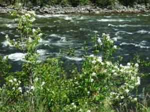
Through much of the last day or so we’ve been cycling through the Nez Perce Indian Reservation. We first came across the story of the Nez Perce at the Big Hole Battleground (see post ‘Freedom but with Reservations’ from July 2nd). As we headed out of Grangeville, we faced a thousand foot climb up into the hills. The heat had gone out of the day, traffic was non-existent and the air was thick with the smell of oranges – mock oranges – the state flower of Idaho which is abundant in this area.
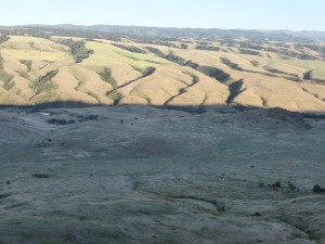
The top of the hill rewarded us with jaw-dropping views of the Nez Perce National Historic Park – the scene really was breathtaking. It also afforded us a fabulous downhill. Halfway down we stopped to look into the valley, scene of the White Bird Battlefield, the first battle of the Nez Perce War on June 17th 1877. Two or three Nez Perce were killed against more than 30 soldiers killed. Although the Nez Perce had won the day it meant war was inevitable – and there would only be one victor.
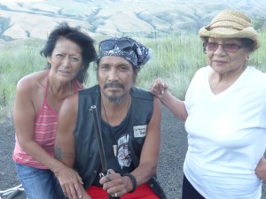
We were about to race down the hill when we were privileged to meet Conrad Claye, his wife Linda and mother Connie. Conrad, a member of the Nez Perce tribe (he was half Nez Perce half Winnebago) told us how the Nez Perce were still fighting to have their tribal rights recognised. He described how their traditional hunting grounds were still being restricted and of the piecemeal and sporadic compensation paid out to Native Americans. At no time did he come across bitter, but a man proud of his peoples history and keen to see that recognised in more than just notice boards pinpointing their historic sites.
We left Conrad, Linda and Connie searching the historic battleground for their Red Setter dog which had gone missing and headed on downhill to White Bird where we met up with Hugh and Chloe from London cycling west to East. We swopped stories and tips as the noise from the bar opposite grew steadily more rowdy until one of the drinkers staggered across the street, handed me a large toad and asked if we’d like any pot. We declined, but did take up the offer of hot showers. Five dollars, handed to a monotone man sitting in a porch, gave us access to camping nirvana and we hunkered down in our tents in the town’s memorial park hoping toad and regulars had hopped it.
Today’s Miles: 44
Miles since First Landing: 3633



Good piece Paul glad it’s going well.
Just back from Lagos, Portugal been thinking of you 2 and letting as many people as possible know about the website too.
“Keep on Cycling”
Regards Martin C
Glad to hear you finally got a decent cup of tea Paul!
Enjoying reading your blog. Keep pedalling!
Fiona x